NAM ‘Atlantic’ launches ScanEagle for the first time
Original article by Guilhereme Wiltgen translated from Portuguese via Google Translate.
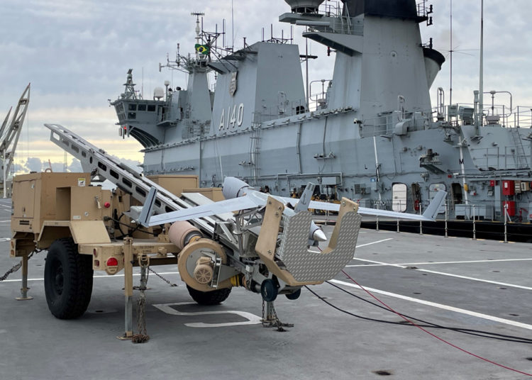
Docked at the Port of Rio Grande (RS), the Multipurpose Aircraft Carrier (NAM) Atlântico (A 140) launched, in an unprecedented way, last Friday (28), an Embedded Remotely Piloted Aerial System (SARP-E).
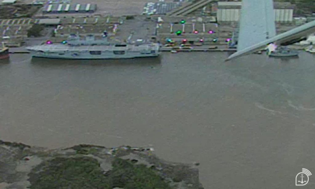
The operation, which represents an important milestone in the technological advancement of the Brazilian Navy (MB), aims to identify the situation of the places most affected by flooding in Rio Grande do Sul, recording situations of flooding, debris and the possibility of places not yet verified.

During the action, regions such as Lagoa dos Patos, Ilha dos Marinheiros and the entire coastal area were observed.
All captured images are transmitted simultaneously to the team on land at the Naval Component Force of the 5th Naval District, in Rio Grande, which is part of the Joint Command of Operation “Taquari 2”.
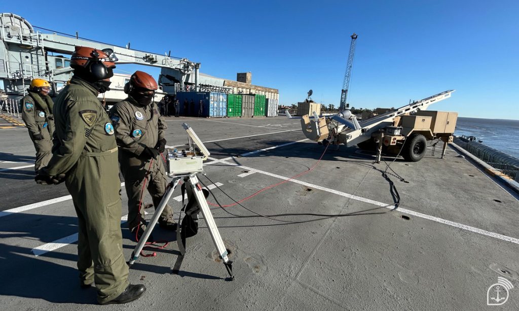
The launch was conducted by the 1st Remotely Piloted Aircraft Squadron (EsqdQE-1). According to one of the team members, the use of technology is another way to support actions in the South. “It is the ability to put the eyes of the Naval Force in the air so that we can observe everything that is necessary and continue to provide humanitarian aid in the region.”
About the aircraft

The Insitu ScanEagle (RQ-1) used is capable of performing surveillance, reconnaissance and data collection missions with high precision. The maximum range is 54 nautical miles (approximately 100 km) from the base ship and up to 24 hours of autonomy.
The equipment, considered low cost, can hold up to eight liters of fuel, has a wingspan of 3.1 meters and has an electro-optical camera with a zoom that zooms in up to 171 times. This means that, flying at an altitude of two thousand feet, the system is capable of recording the image of a vehicle’s license plate, for example.
For the operation to be carried out, the Squadron needs to embark all the support material such as the launcher, the control station and the recovery system. The process of returning the aircraft occurs by reducing its speed until it is captured.
Technological advancement in the Force
With this launch, the Brazilian Navy is adapting to the needs of the operation with the resources and capabilities it already has and paves the way for future SARP-E operations from the Atlantic. The expectation is that, with the continuous development and adoption of new technologies, drones will play an increasingly important role in several areas, contributing to safety, efficiency and sustainable development.

This milestone reinforces the Navy’s role in the search for innovative solutions for the benefit of society and the country’s defense.
Original article in Portuguese…
NAM ‘Atlântico’ lança o ScanEagle pela primeira vez

Atlântico (A 140) lançou de forma inédita na última sexta-feira (28), um Sistema Aéreo Remotamente Pilotado Embarcado (SARP-E).
A operação, que representa um marco importante no avanço tecnológico da Marinha do Brasil (MB), tem o objetivo de identificar a situação dos locais mais afetados pelas enchentes no Rio Grande do Sul, registrando situações de alagamento, destroços e a possibilidade de locais ainda não verificados.

Durante a ação, foram observadas regiões como a Lagoa dos Pat
os, a Ilha dos Marinheiros e toda área da costa.
Todas as imagens captadas são transmitidas simultaneamente para a equipe em terra na Força Naval Componente do 5º Distrito Naval, em Rio Grande, que faz parte do Comando Conjunto da Operação “Taquari 2”.
O lançamento foi conduzido pelo 1º Esquadrão de Aeronaves Remotamente Pilotadas (EsqdQE-1). De acordo com um dos integrantes da equipe, o uso da tecnologia é mais uma forma da apoiar as ações no Sul. “Trata-se da capacidade de colocar os olhos da Força Naval no ar para que a gente possa observar tudo que for necessário e poder dar continuidade à ajuda humanitária na região.”
Sobre a aeronave

O Insitu ScanEagle (RQ-1) utilizado tem capacidade de realizar missões de vigilância, reconhecimento e coleta de dados com alta precisão. O alcance máximo é de 54 milhas náuticas (aproximadamente 100 km) de distância do navio-base e até 24 horas de autonomia.
O equipamento, considerado de baixo custo, recebe até oito litros de combustível, tem 3,1 metros de envergadura e possui uma câmera eletro-ótica com um zoom que aproxima em até 171 vezes. Isso significa que, sobrevoando a dois mil pés de altitude, o sistema é capaz de registrar a imagem da placa de um veículo, por exemplo.
Para que a operação seja realizada, o Esquadrão precisa embarcar todo o material de apoio como o lançador, a estação de controle e o sistema de recolhimento. O processo de retorno da aeronave ocorre a partir da redução da velocidade, até que ela seja capturada.
O avanço tecnológico na Força
Com o lançamento, a Marinha do Brasil se adéqua à necessidade da operação com os meios e capacidades que já possui e abre caminho para futuras operações de SARP-E, a partir do Atlântico. A expectativa é que, com o contínuo desenvolvimento e a adoção de novas tecnologias, os drones desempenhem um papel cada vez mais importante em diversas áreas, contribuindo para a segurança, a eficiência e o desenvolvimento sustentável.

Esse marco reforça o papel da Marinha na busca por soluções inovadoras em prol da sociedade e da defesa do País.
Related News
Brazilian Navy makes first ScanEagle drone launch
July 02, 2022Read more
Related News
QE-1 Squadron turns 2 years old
The military ceremony took place at the São Pedro da Aldeia Naval Air Base
Read More »Insitu anticipates adding payloads to ScanEagle and Integrator, finds FLARES customer
Unmanned aerial vehicle (UAV) manufacturer Insitu intends to introduce a suite of new capabilities over the next five years
Read More »ScanEagle Deployed on The Frigate Canarias Assists in the Liberation of a Ship Kidnapped by Pirates in Somali Waters
ScanEagle assists in the release of the ship ABDULLAH and its 23 crew members.
Read More »